Natural visitor flows emerge in response to the
spatial cues of a given setting. Signage cannot
create these natural flows, it can only respond
to them. This recognises that long before we
encounter a given visitor orientation sign we
are responding to our surroundings on an
emotive and intuitive level.
Recognising both the limitations and
obligations of signage is an essential first step
in the development of a coherent wayfinding
experience. Wayfinding must integrate with
the broader context of placemaking.
When we think of how we recall some places
as being “easy to get around” it is not likely
that we are remembering the signage. The best indicator of effective wayfinding is that we use it without noticing it.
If you remember a precinct's wayfinding at all, it's probably because you got lost or couldn't make clear decisions about the resources and facilities on offer around you.
This is why placemaking is such an integral part of effective wayfinding. Placemaking primarily connects with our emotional and intuitive responses. It invites us to get a feeling for a place before then learning more about it in order to attribute values and meanings to the site and the experiences on offer.
This takes the wayfinding focus away from signs in the first instance. Rather it recognises that it is the landscape settings and general surroundings within which we encounter the signs which will strongly influence their utility. In essence all effective wayfinding responses rest on the foundation of considered landscape design.
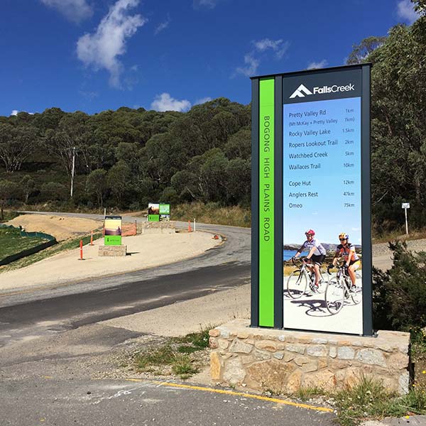
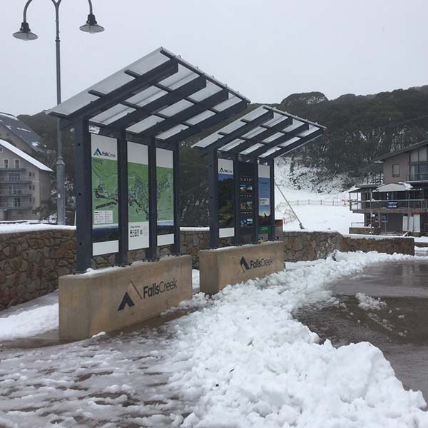
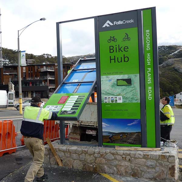
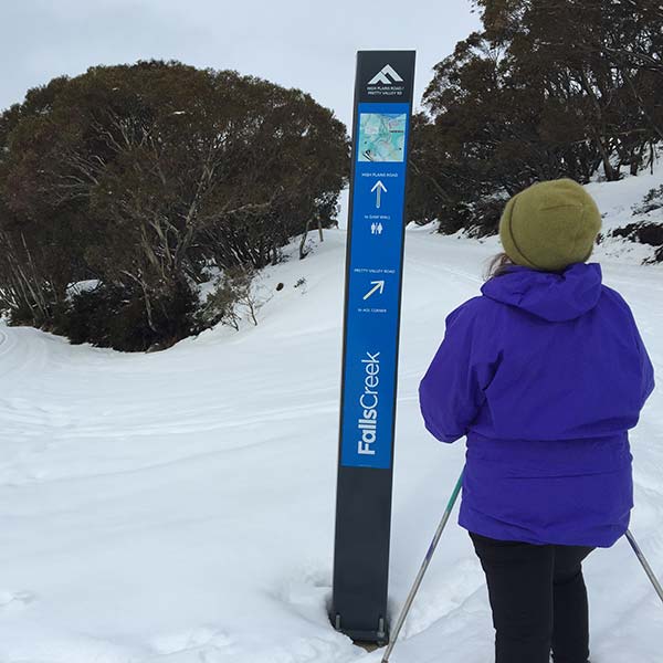
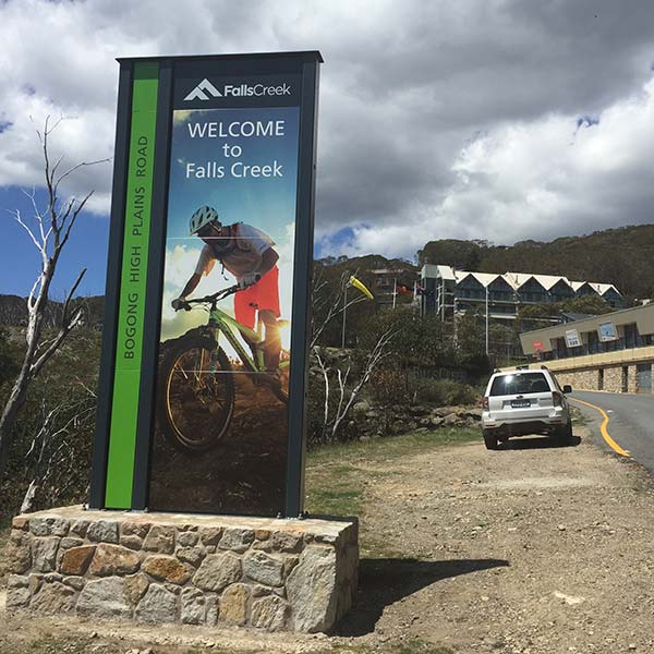
We see this in relation to major signage programs such as that featured here for the Falls Creek Alpine Resort. It can also relate to simpler responses such as installing seating at key wayfinding nodes such as to invite people to step aside for a moment from their journey in order to fully engage with the information on offer.
The essential role mapping plays in visitor orientation is apparent when we build a wayfinding model up from first principles. This recognises that a key responsibility of management is to tell people where they are. Identifying a place’s location is an objective statement of direct relevance to all users.
Attempting to predict where users might be going and indicating how to
get there however is a subjective matter. This requires management to make choices in advance as regards what possible destinations to feature and these may or may not be of relevance to the user.
The central pillar of wayfinding is the idea that the user should encounter the same wayfinding and orientation content irrespective of the media being used to publish it.
Basically the content they see on their phones is the same as the content they see in the signs around them. This is a fundamental project requirement arrived at when building a wayfinding solution from first principles by following a User Experience (UX) design pathway.
The central obligation for wayfinding is to tell people where they are. This is essential both in terms of identifying how they will get to where they want to go and also to be able to easily inform others of their location. This is especially relevant in the case of emergency services, but it can also be helpful in the event of member of a party becoming separated.
For areas where the wayfinding signage is located in areas with internet coverage, the ///what3words system is now established as the optimal means by which we can do this.
Since October 2020, the system has been a central feature of the official Australian emergency services 'Emergency Plus' app. Our work with the Parramatta City Council in relation to the wayfinding for the Lake Parramatta Reserve in 2020 provided the first opportunity for us to include this component as an integral element of the wayfinding solution.
about ///what3words
Inbuilt navigational apps like Google maps and Apple maps are both instantly available and very familiar to almost every user.
These are a valuable means of telling people where they are. On their own however, they are of limited utility in communicating this information to others given the bewildering complexity of relaying the lat/long coordinates that define this location with metre by metre precision. The ability of these mapping APIs in getting you to where you want to go is also dependent on you being able to identify your intended destination with precision.

It was recognition of these limitations that led to the British development of the ///what3words app in 2013. ///what3words is a geocode system designed to identify any location on earth with a resolution of about 3 metres. The system encodes geographic coordinates into three permanently fixed dictionary words.
///what3words divides the world into a grid of 57 trillion 3-by-3-metre squares, each of which has a three-word address.
The idea was conceived by an event organizer who struggled to get bands and equipment to music venues using inadequate address information. He tried using GPS coordinates to locate the venues, but decided that words were better than numbers after a one-digit error led him to the wrong location.
Users can valuably be encouraged to download the ///what3words app as a priority tool for enhancing their experience. They can then use the app navigation button to open this directly in either Apple or Google maps whereupon they can receive voice commanded step by step instructions on how to get to their destination.
Similarly if a group is out on the trail network and become separated, they can simply tell their associates of precisely where they are by sharing their three word location address. In the event of a group member losing the path and being disoriented in the bush, this system allows them to communicate directly without emergency services support.